
HIKING SPOTS IN CALIFORNIA
- Jasmine Ayers
- Jan 30, 2021
- 6 min read

Updated: Mar 8, 2021
I wanted to add a post about hiking spots in California that I have gone to so far! I get a lot of requests from people about hiking trails that I post up on the gram! Sooo without further ado here are just a few of my favorites! 🌲
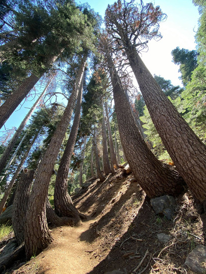
Sequoia National Park - Mineral King to Eagle Lake Trail
Length: 6.5 miles
Elevation Gain: 2,214 ft.
Route Type: Out & Back
Difficulty: Hard
Time: 4-5 hours
Parking/Fees: Make sure to check out the National Park website to get any updated info. on current conditions, permits, and fees: https://www.nps.gov/seki/planyourvisit/fees.htm
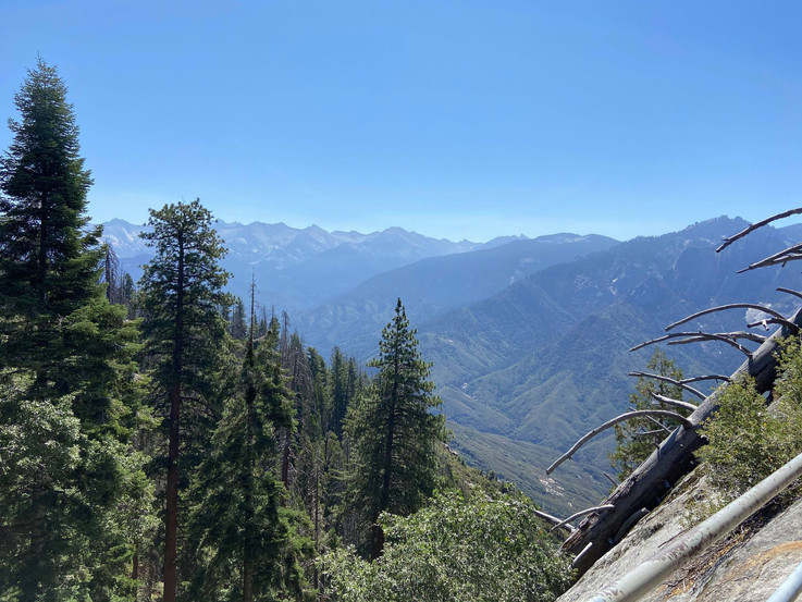
This trail was honestly SO breath taking. I don't think there was any incline, decline, or turn that wasn't just, BEAUTIFUL. I kept saying that if fairies were real, this is where they would live. I went on this trail during the summer months (around the beginning of August I believe). My Yosemite camping trip got cancelled last minute and I had to think of another way to spend my vacation days. I decided to go on a little last minute two day hiking trip with a couple of friends, and let me tell you, this trip did not disappoint!
We stayed in a quaint motel (The River Inn) near the road that took us to the trail. The drive to the trail head was about an hour with a lot of windy turns and crazy bumps! Parking is free once you get there and the beginning of the trail is easy enough to see.
Once you start walking, you just see that everything is lush and green! Flowers everywhere, tall grass on either side of you with pine trees standing tall. To the left there's a valley and on the other side are mountains with a waterfall. Butterflies were flying everywhere and deer were going about their business. This trail may only be 6.5 miles in and out but there is a lot of incline so it will feel like more. Towards the last stretch of the hike, you'll come to an area where it'll break off to a fork in the road with no sign. On the left there will be more forest, and to the right are a bunch of rocks. You'll want to climb up the rocks in order to continue onto the right path towards the lake. Bring a good amount of water and snacks! You'll need it!
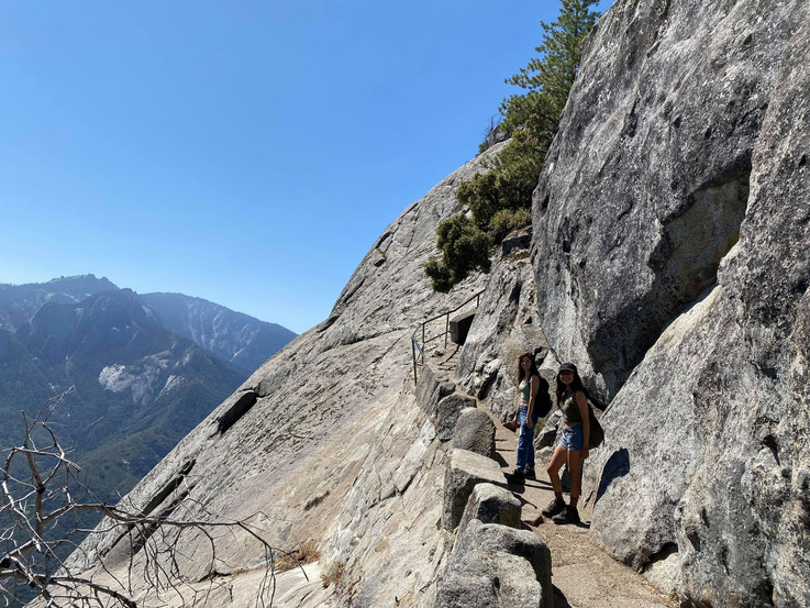
On the second day, before we left Sequoia, we went to Moro Rock Trail which is a short walk up a stair case to a viewpoint that let's you see a panoramic view of Sequoia National Park. It's a great place to stop by while in Sequoia to get great views without having to break much of a sweat. The distance is about 0.4 miles up with 187 ft. elevation gain.
We also stopped by the General Sherman Tree Trail; a 0.9 mile out and back trail. This trail was easy and is great for people of any age. This trail leads to the world's largest tree - by volume - The General Sherman Tree! If you'd like more information about the General Sherman Tree, visit: https://www.nps.gov/seki/learn/nature/sherman.htm
The distance between Morro Rock Trail and General Sherman Tree Trail is about 3.8 miles (12 minutes). So both are great to visit on the same day, giving you more time to visit other sites afterwards.


Yosemite National Park - Glacier Point's 4 Mile Trail
Length: 4.6 miles
Elevation Gain: 3,200 ft.
Route Type: Out & Back
Difficulty: Strenuous
Time: 3-4 hours one way, 6-8 hours round trip
Begin at: Four Mile Trailhead along Southside Drive in Yosemite Valley near Sentinel Rock
Parking/Fees: Make sure to check out the National Park website to get any updated info. on current conditions, permits, and fees: https://www.nps.gov/yose/index.htm
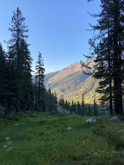
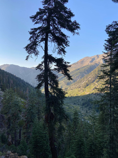
Yosemite is by far one of my favorite National Parks! I've only been there once... BUT I know beautiful landscapes when I see them and Yosemite definitely has breathtaking views - robust waterfalls, tall pines, and giant mountains. It's a breath of fresh air, away from the hustle and bustle of Southern California.
The 4 Mile Trail up towards Glacier Point is arduous and you'll definitely need some stamina and endurance built up for this hike. It's basically all incline. I went to this trail in April which made it difficult to go all the way up. I was only able to make it up halfway - 2.8 miles - due to the amount of snow that was covering the higher points. There was a gate placed at the 2.8 mile mark warning people that they could continue, but only at their own risk. The trail is narrow, and because of the snow at that time, you could have a hard time figuring out if you're walking on the trail or just a sheet of snow. Anyone who did continue had hiking poles and other gear that I, unfortunately, did not have on hand.
If you're interested in this trail, it has amazing views of Half Dome, Yosemite Valley, El Capitan, and Yosemite Falls.
As stated before, I had a camping trip planned to hike up Half Dome in August of 2020, however, the park closed off our campsite for one week and that one week just happened to fall on the week my friends and I were suppose to go! What are the chances!? Oh well! There's always next time! When I am finally able to hike up Half Dome I will definitely post about it! It'll be a hike that I'll need to train for, but I'm up for the challenge!


Black Star Canyon Falls
Length: 6.8 miles
Elevation Gain: 941 ft.
Route Type: Out & Back
Difficulty: Moderate (All Trails says hard, but eh)
Time: 3 hours 30 min.
Address: 10499, 10967 Black Star Canyon Rd, Silverado, CA 92676
Parking/Fees: Free
This trail is located in Silverado, CA and is a pretty good hike to go on during a day off. I currently reside in Anaheim Hills and it's about a 33 minute drive to the trail head. A 33 minute drive is awesome considering all of the other trails that I'd prefer to go on are at least an hour away. This trail leads to a waterfall at the end and has heavy traffic so make sure to bring a mask!
While hiking along this trail there's a creek that follows you all the way to the waterfall! Make sure to bring good hiking shoes because there are areas that can be slippery and also areas where you may need to climb. Right before you can get to the waterfall, there's a steep area where you will need to climb up using a rope that is hanging there. I used the rope to help pull myself up and tried not to rely on it too much. I saw someone try to use only the rope and it didn't work out too well for them! So just make sure you do what's comfortable for you while climbing up.
Highly recommend for a good, quick day hike!


Idyllwild Suicide Rock via Deer Springs Trail
Length: 7.9 miles
Elevation Gain: 1,853 ft.
Route Type: Out & Back
Difficulty: Moderate
Time: 3 hours 50 min.
Address: Deer Spring Trail, Idyllwild-Pine Cove, CA 92549
Parking/Fees: Free
Idyllwild's Suicide Rock trail head is right off the main road of Esperanza Firefighters Memorial Hwy. There should be a little dirt area to park. My friend and I missed it the first time and had to make a U-Turn.
Once you park, the trail is pretty easy to spot. It'll start going up from there and it's pretty easy in regards to incline. There are areas of incline of course, but there area also a lot of areas of just flat walking. You'll definitely want some hiking boots for this hike as there can be snow during winter/spring months. While going up the mountain there were beautiful creeks and we were able to see/hear woodpeckers in the trees.
The trail is a beautiful one to take for a weekend hike and if you have a full day, I would go as early as possible, that way you can enjoy the town afterwards as well. Idyllwild's village has little shops and restaurants that you can check out. If you like crystals and incense like I do, there's a shop called, Earth's Elements, right in the center of town.
All in all, Idyllwild is a beautiful area for hiking and would recommend it for a day trip or any camping that you may want to do in order to get away for a short time.


Welp! That's all for this hiking post!
Let me know if you'd like to know about other hiking spots and if you've ever been to these one listed! Also let me know if you have any suggestions on hiking trails that you've been on and like me to try out. I love the hiking community! Stay active, wild, and free my friends!


Comments